 |
VR-Forces 4.1.1 Class Documentation
|
|
VR-Forces 4.1.1 Class Documentation
|
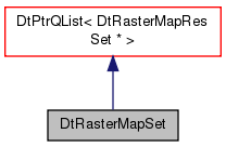
DtRasterMapSet Contains a list of DtRasterMapResSets This is the top level of the raster map config. More...
Public Member Functions | |
| DtRasterMapSet () | |
| default constructor | |
| DtRasterMapSet (const DtRasterMapSet &orig) | |
| copy constructor | |
| DtRasterMapSet & | operator= (const DtRasterMapSet &orig) |
| assignment operator | |
| virtual DtRasterMapSet * | clone () const |
| virtual | ~DtRasterMapSet () |
| destructor | |
| virtual void | readFromMtlFile (DtlObjPtr &mtlObj) |
| virtual bool | writeToMtlFile (FILE *fp, int indentLevel=0) const |
| virtual void | putIndent (FILE *fp, int indentLevel) const |
| virtual bool | addEntry (const DtRasterMapResSet &entry) |
| virtual bool | prependEntry (const DtRasterMapResSet &entry) |
| virtual DtRasterMapResSet * | resSetForRes (const double res) const |
| returns a pointer to the resolution set appropriat for the specified resolution, or NULL if there isn't one. | |
| virtual DtRasterMap * | mapContainingForRes (const DtPoint &point, const double res) const |
| returns a pointer the the map that contains the specified point and is for the specified resolution. | |
| void | setGeodetic (bool) |
| bool | geodetic () const |
| void | setImageSize (int, int) |
| const QSize & | imageSize () const |
| void | setExtentScaleX (double d) |
| double | extentScaleX () const |
| void | setExtentScaleY (double d) |
| double | extentScaleY () const |
| virtual void | convertTo (const Coordinate_System *coordSys) |
| int | version () const |
 Public Member Functions inherited from DtPtrQList< DtRasterMapResSet * > Public Member Functions inherited from DtPtrQList< DtRasterMapResSet * > | |
| DtPtrQList () | |
| DtPtrQList (const DtPtrQList< DtRasterMapResSet * > &orig) | |
| DtPtrQList () | |
| DtPtrQList (const DtPtrQList< DtRasterMapResSet * > &orig) | |
| virtual | ~DtPtrQList () |
| virtual | ~DtPtrQList () |
| void | clear () |
| void | clear () |
| void | setAutoDelete (bool b) |
| void | setAutoDelete (bool b) |
| bool | autoDelete () const |
| bool | autoDelete () const |
| DtPtrQList< DtRasterMapResSet * > ::iterator | erase (typename DtPtrQList< DtRasterMapResSet * >::iterator pos) |
| DtPtrQList< DtRasterMapResSet * > ::iterator | erase (typename DtPtrQList< DtRasterMapResSet * >::iterator first, typename DtPtrQList< DtRasterMapResSet * >::iterator last) |
| DtPtrQList< DtRasterMapResSet * > ::iterator | erase (typename DtPtrQList< DtRasterMapResSet * >::iterator pos) |
| DtPtrQList< DtRasterMapResSet * > ::iterator | erase (typename DtPtrQList< DtRasterMapResSet * >::iterator first, typename DtPtrQList< DtRasterMapResSet * >::iterator last) |
| int | findRef (DtRasterMapResSet *t) const |
| int | findRef (DtRasterMapResSet *t) const |
| int | find (DtRasterMapResSet *t) const |
| int | find (DtRasterMapResSet *t) const |
| void | removeRef (DtRasterMapResSet *t) |
| void | removeRef (DtRasterMapResSet *t) |
| void | remove (DtRasterMapResSet *t) |
| void | remove (DtRasterMapResSet *t) |
| void | removeAt (int i) |
| void | removeAt (int i) |
Protected Member Functions | |
| virtual bool | addEntry (DtRasterMapResSet *entry) |
| virtual bool | prependEntry (DtRasterMapResSet *entry) |
| virtual void | copyList (const DtRasterMapSet &orig) |
Protected Attributes | |
| bool | myGeodetic |
| double | myExtentScaleX |
| double | myExtentScaleY |
| QSize | myImageSize |
| int | myVersion |
| Protected Attributes inherited from DtPtrQList< DtRasterMapResSet * > | |
| bool | myAutoDelete |
DtRasterMapSet Contains a list of DtRasterMapResSets This is the top level of the raster map config.
Each DtRasterMapResSet contians a set of maps for a particular resolition range.
| DtRasterMapSet::DtRasterMapSet | ( | ) |
default constructor
| DtRasterMapSet::DtRasterMapSet | ( | const DtRasterMapSet & | orig | ) |
copy constructor
|
virtual |
destructor
| DtRasterMapSet& DtRasterMapSet::operator= | ( | const DtRasterMapSet & | orig | ) |
assignment operator
|
virtual |
|
virtual |
|
virtual |
|
virtual |
|
virtual |
|
virtual |
|
virtual |
returns a pointer to the resolution set appropriat for the specified resolution, or NULL if there isn't one.
|
virtual |
returns a pointer the the map that contains the specified point and is for the specified resolution.
returns NULL if there is no such map.
|
inline |
References myGeodetic.
|
inline |
References myGeodetic.
|
inline |
References myImageSize.
|
inline |
References myImageSize.
|
inline |
References myExtentScaleX.
|
inline |
References myExtentScaleX.
|
inline |
References myExtentScaleY.
|
inline |
References myExtentScaleY.
|
virtual |
|
inline |
References myVersion.
|
protectedvirtual |
|
protectedvirtual |
|
protectedvirtual |
|
protected |
Referenced by geodetic(), and setGeodetic().
|
protected |
Referenced by extentScaleX(), and setExtentScaleX().
|
protected |
Referenced by extentScaleY(), and setExtentScaleY().
|
protected |
Referenced by imageSize(), and setImageSize().
|
protected |
Referenced by version().