 |
VR-Forces 4.1.1 Class Documentation
|
|
VR-Forces 4.1.1 Class Documentation
|
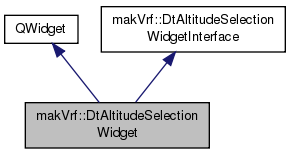
Public Member Functions | |
| DtAltitudeSelectionWidget (makVrv::DtDe &de, QWidget *parent, const Qt::WindowFlags &flags=0) | |
| virtual | ~DtAltitudeSelectionWidget () |
| virtual DtAltitudeClampType | currentAltitudeTypeSelection () const |
| virtual void | setCurrentAltitudeTypeSelection (const DtAltitudeClampType &type) |
| virtual double | altitude () const |
| Returns altitude value in meters and local. | |
| virtual QString | zValue () const |
| Returns altitude as text. | |
| virtual void | setZLabel (const QString &) |
| Sets the label of the altitude text entry. | |
| virtual bool | eventFilter (QObject *, QEvent *) |
| Called for events, if focus is received in the ground or sea level, signal receivedFocus. | |
| virtual void | setAltitudeDecimals (int decimals) |
| Sets the precision of the altitude entries. | |
| virtual void | setLocation (DtVector, bool resetAltitude=false) |
| Expects value in meters and local. | |
| virtual DtGeodeticCoord | geodeticLocation () const |
| virtual double | altitudeAboveSeaLevel () const |
| virtual void | setAltitudeAboveSeaLevel (double) |
| virtual void | setAltitudeAboveSeaLevel (const QString &) |
| virtual void | setAltitudeAboveSeaLevelLabel (const QString &) |
| virtual double | altitudeAboveGroundLevel () const |
| virtual void | setAltitudeAboveGroundLevel (double) |
| virtual void | setAltitudeAboveGroundLevel (const QString &) |
| virtual void | setAltitudeAboveGroundLevelLabel (const QString &) |
| virtual void | setMouseClickSupportEnabled (bool) |
| Enables/disables mouse selection handling for mouse down. Default is turned off. | |
| virtual void | setDisplayOnlyMode (bool) |
| Sets "display only" mode on/off. If on will show a label (altitude) and the combo box for selection. | |
| virtual bool | displayOnlyMode () const |
| Returns whether or not in display only mode. | |
| virtual void | setLabel (const QString &) |
| QString | label () const |
| virtual void | setCoordinateSystem (const makArchives::DtDisplayUnitsSettingsRecord::CoordSys &) |
| Calls down to logic to set coordinate system. | |
| const makArchives::DtDisplayUnitsSettingsRecord::CoordSys & | coordinateSystem () const |
| virtual void | setIgnoreList (const std::vector< makVrv::DtElementID > &) |
| List of objects to ignore when getting intersections. | |
| virtual const std::vector < makVrv::DtElementID > & | ignoreList () const |
| virtual void | setAltitudeAboveSeaLevelSelected (bool b) |
| Altitude above sea level UI modifiers. | |
| virtual void | setAltitudeAboveSeaLevelEnabled (bool b) |
| virtual void | setAltitudeAboveSeaLevelVisible (bool b) |
| virtual void | setAltitudeAboveGroundLevelSelected (bool b) |
| Altitude above ground level UI modifiers. | |
| virtual void | setAltitudeAboveGroundLevelEnabled (bool b) |
| virtual void | setAltitudeAboveGroundLevelVisible (bool b) |
| virtual void | refreshLabels () |
| virtual void | setClampToNearestPolygon (bool) |
| Sets whether or not to clamp to nearest polygon when selecting altitude. Default is true. | |
 Public Member Functions inherited from makVrf::DtAltitudeSelectionWidgetInterface Public Member Functions inherited from makVrf::DtAltitudeSelectionWidgetInterface | |
| virtual | ~DtAltitudeSelectionWidgetInterface () |
Protected Slots | |
| virtual void | slot_onAltitudeSelectionTypeChanged () |
| virtual void | slot_onAltitudeAboveSeaLevelEdited () |
| virtual void | slot_onAltitudeAboveGroundLevelEdited () |
Protected Attributes | |
| makVrv::DtDe & | myDe |
| makVrf::DtAltitudeSelectionWidget::DtAltitudeSelectionWidget | ( | makVrv::DtDe & | de, |
| QWidget * | parent, | ||
| const Qt::WindowFlags & | flags = 0 |
||
| ) |
|
virtual |
|
virtual |
Implements makVrf::DtAltitudeSelectionWidgetInterface.
|
virtual |
Implements makVrf::DtAltitudeSelectionWidgetInterface.
|
virtual |
Returns altitude value in meters and local.
Implements makVrf::DtAltitudeSelectionWidgetInterface.
|
virtual |
Returns altitude as text.
Implements makVrf::DtAltitudeSelectionWidgetInterface.
|
virtual |
Sets the label of the altitude text entry.
Implements makVrf::DtAltitudeSelectionWidgetInterface.
Called for events, if focus is received in the ground or sea level, signal receivedFocus.
|
virtual |
Sets the precision of the altitude entries.
Implements makVrf::DtAltitudeSelectionWidgetInterface.
|
virtual |
Expects value in meters and local.
Implements makVrf::DtAltitudeSelectionWidgetInterface.
|
virtual |
|
virtual |
Implements makVrf::DtAltitudeSelectionWidgetInterface.
|
virtual |
Implements makVrf::DtAltitudeSelectionWidgetInterface.
|
virtual |
Implements makVrf::DtAltitudeSelectionWidgetInterface.
|
virtual |
Implements makVrf::DtAltitudeSelectionWidgetInterface.
|
virtual |
Implements makVrf::DtAltitudeSelectionWidgetInterface.
|
virtual |
Implements makVrf::DtAltitudeSelectionWidgetInterface.
|
virtual |
Implements makVrf::DtAltitudeSelectionWidgetInterface.
|
virtual |
Implements makVrf::DtAltitudeSelectionWidgetInterface.
|
virtual |
Enables/disables mouse selection handling for mouse down. Default is turned off.
|
virtual |
Sets "display only" mode on/off. If on will show a label (altitude) and the combo box for selection.
|
virtual |
Returns whether or not in display only mode.
Implements makVrf::DtAltitudeSelectionWidgetInterface.
|
virtual |
| QString makVrf::DtAltitudeSelectionWidget::label | ( | ) | const |
|
virtual |
Calls down to logic to set coordinate system.
Implements makVrf::DtAltitudeSelectionWidgetInterface.
| const makArchives::DtDisplayUnitsSettingsRecord::CoordSys& makVrf::DtAltitudeSelectionWidget::coordinateSystem | ( | ) | const |
|
virtual |
List of objects to ignore when getting intersections.
|
virtual |
|
virtual |
Altitude above sea level UI modifiers.
Implements makVrf::DtAltitudeSelectionWidgetInterface.
|
virtual |
Implements makVrf::DtAltitudeSelectionWidgetInterface.
|
virtual |
Implements makVrf::DtAltitudeSelectionWidgetInterface.
|
virtual |
Altitude above ground level UI modifiers.
Implements makVrf::DtAltitudeSelectionWidgetInterface.
|
virtual |
Implements makVrf::DtAltitudeSelectionWidgetInterface.
|
virtual |
Implements makVrf::DtAltitudeSelectionWidgetInterface.
|
virtual |
Implements makVrf::DtAltitudeSelectionWidgetInterface.
|
virtual |
Sets whether or not to clamp to nearest polygon when selecting altitude. Default is true.
|
protectedvirtualslot |
|
protectedvirtualslot |
|
protectedvirtualslot |
|
protected |
| QGroupBox* makVrf::DtAltitudeSelectionWidget::myGroupBox |
| QGridLayout* makVrf::DtAltitudeSelectionWidget::myGridLayout |
| QRadioButton* makVrf::DtAltitudeSelectionWidget::myAltitudeSLevelRadioButton |
| QRadioButton* makVrf::DtAltitudeSelectionWidget::myAltitudeGLevelRadioButton |
| QLineEdit* makVrf::DtAltitudeSelectionWidget::myAltitudeSLevelLineEdit |
| QLineEdit* makVrf::DtAltitudeSelectionWidget::myAltitudeGLevelLineEdit |
| QDoubleValidator* makVrf::DtAltitudeSelectionWidget::myValidator |
| bool makVrf::DtAltitudeSelectionWidget::myJustSetup |
| bool makVrf::DtAltitudeSelectionWidget::myDisplayOnlyMode |
| QHBoxLayout* makVrf::DtAltitudeSelectionWidget::myDisplayOnlyLayout |
Only valid in display only mode.
| QLabel* makVrf::DtAltitudeSelectionWidget::myDisplayOnlyLabel |
| DtAltitudeSelectionWidgetLogic* makVrf::DtAltitudeSelectionWidget::myLogic |