 |
VR-Forces 4.10 Class Documentation
|


All Classes Namespaces Files Functions Variables Typedefs Enumerations Enumerator Properties Friends Macros Groups Pages
|
VR-Forces 4.10 Class Documentation
|
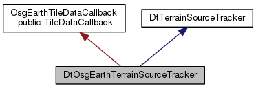
Classes | |
| struct | IndexConfig |
| Information about each individual index file. More... | |
| class | IndexInputInterface |
| Generic interface for reading from index. More... | |
Public Member Functions | |
| DtOsgEarthTerrainSourceTracker (DtVantageTerrainEngine *, DtPagerCommandQueue *commandQueue, osgEarth::MapNode *mapNode) | |
| virtual bool | useRawElevation () const |
| True if using elevation data (i.e. if using osgEarth REX engine). More... | |
| virtual bool | useLandCoverData () const |
| Return true if the current tracker use land cover data. More... | |
| unsigned | getHighestLodForLandCover () const |
| void | setLandCoverSurfaceCharacteristicsMapper (makVrf::DtSurfaceCharacteristicMap *mapper) |
| void | getSoilFromString (const std::string &soilType, DtSurface &surface) const |
| virtual const osg::ref_ptr < osgEarth::LandCoverLayer > | getBestLandCoverLayer (const osgEarth::TileKey &key) const |
| virtual boost::optional < DtTerrainIntersectOptions::Fidelity > | intersectFidelity () const |
| Fidelity this tracker is configured for. More... | |
| virtual unsigned | tileCount () const |
| Number of currently paged in tiles. More... | |
| virtual unsigned | cellCount () const |
| Number of cells in index. More... | |
| virtual bool | init (DtTerrainSourcePager &) |
| Initialize after configuration. More... | |
| virtual void | addPagedInTile (const osgEarth::TileKey &tilekey, const boost::shared_ptr< DtTileData > &tileData) |
| Adds a tileId and the corresponding tileData to #myPagedInTiles. More... | |
| virtual void | removePagedInTile (const osgEarth::TileKey tileKey) |
| Removes a tileId and the corresponding tileData from #myPagedInTiles. More... | |
| virtual bool | dataAvailable (DtPagingMetaDataPtr metaData, DtTerrainPagingGeometryPtr geometry) |
| Finds all tiles within geometry, and tests to see whether they have all been paged in already. More... | |
| virtual bool | findHeightFieldIntersections (DtTerrainIntersectStatus &status, const DtChord &chord, DtVrfChordIntersectRecordList &intList, const DtTerrainIntersectOptions &options) const |
| Performs terrain intersections. More... | |
| virtual bool | halveChordAndFindHeightFieldIntrx (const DtChord &chord, DtChord convertedChord, const DtTerrainIntersectOptions &options, DtTerrainIntersectStatus &status, DtVrfChordIntersectRecordList &intList) const |
| Used in findHeightFieldIntersections. More... | |
| virtual bool | splitChordAt180AndFindHeightFieldIntrx (const DtChord &chord, const DtTerrainIntersectOptions &options, DtTerrainIntersectStatus &status, DtVrfChordIntersectRecordList &intList) const |
| Used in findHeightFieldIntersections. More... | |
| virtual void | processTriangles (DtTriangleOutputInterface &output, const DtTerrainProcessPolygonsBox &box) |
| Outputs triangles interpolated from elevation data. More... | |
| virtual void | pageInData (DtPagingMetaDataPtr metaData, DtTerrainPagingGeometryPtr geometry) |
| Page in data within geometry. More... | |
| virtual DtTerrainIntersectIDType | findOldestPagedData (unsigned int &numTrianglesOut) |
| Finds the least-recently-used tile and set myOldestPagedObject to it. More... | |
| virtual void | pageOutOldestData (const int priority) |
| Adds a page out command for the least-recently-used tileID to myCommandQueue. More... | |
| virtual bool | canPageOutData (DtTerrainIntersectIDType intersectId) |
| Returns true if there is data that can be paged out. More... | |
| virtual osgEarth::TileKey | getBestTileKey (const osgEarth::TileKey &) const |
| Uses osgearth layer data to find the smallest lod for a given area that actually has data. More... | |
| virtual void | findMissingTiles (const DtTerrainPagingGeometryPtr &geometry, DtTileKeyList &tiles) const |
| Find all the tiles that intersect the geometry which are not paged in. More... | |
| void | findPagedInTilesWithinExtent (std::vector< osgEarth::TileKey > &tileKeysPagedIn, const osgEarth::GeoExtent &extent) const |
| ! Finds the TileKeys for all of the Paged in Tiles that intersect the geo extent More... | |
| void | findPagesAtLodWithinExtents (std::vector< osgEarth::TileKey > &tileKeysFound, const osgEarth::GeoExtent &extent, unsigned lod) const |
| virtual void | writeIndex (IndexInterface &, IndexOutputInterface &) const |
| Writes an index using the whole terrain (i.e. merged) elevation data. More... | |
| virtual bool | writeIndexLayers (IndexInterface &, unsigned precision) const |
| Writes indices for each elevation layer. More... | |
| virtual std::vector< IndexConfig > | getIndexConfigInfoForLayer (const osgEarth::ElevationLayer &layer) const |
| Return vector of index config objects, one per each index set in layer. More... | |
| virtual void | readIndex (IndexInputInterface &, unsigned layerNumber, const IndexConfig &idxConfig) |
| Reads an index file. More... | |
| virtual bool | readIndexLayers () |
| Reads per layer index files. More... | |
| OsgEarthTileDataCallback () | |
| virtual bool | operator() (const boost::shared_ptr< DtTileData > &tile)=0 |
| virtual unsigned | maxLOD () const |
| Max lod that the tracker will generate. More... | |
| virtual void | setMaxLOD (unsigned) |
| virtual unsigned | getMaxLODForBilinearIntersection () const |
| Max lod at which intersections will be done by exact solution of bilinear surface. More... | |
| virtual void | setMaxLODForBilinearIntersection (unsigned) |
| virtual double | triangleOutputMergeTolerance () const |
| If the max difference between true elevation and elevation defined by the two triangles that make up this cell is less than this value then the system will use those two triangles instead of breaking them up further. More... | |
| virtual void | setTriangleOutputMergeTolerance (double tol) |
| virtual double | intersetionTriangleMergeTolerance () const |
| virtual void | setIntersectionTriangleMergeTolerance (double tol) |
| virtual unsigned | minElevationIndexLOD () const |
| Sets the range of LOD levels where elevation values from the terrain index will be used. More... | |
| virtual void | setMinElevationIndexLOD (unsigned) |
| virtual unsigned | maxElevationIndexLOD () const |
| virtual void | setMaxElevationIndexLOD (unsigned) |
| virtual double | maxChordLengthBeforeSplitSquared () const |
| Set the max chord length before chords are split. More... | |
| virtual void | setMaxChordLengthBeforeSplit (double) |
| virtual unsigned | maxElevationChordSplitTestLOD () const |
| Sets the max lod used to estimate max terrain elevation under chords. More... | |
| virtual void | setMaxElevationChordSplitTestLOD (unsigned) |
 Public Member Functions inherited from DtTerrainSourceTracker Public Member Functions inherited from DtTerrainSourceTracker | |
| DtTerrainSourceTracker (DtVantageTerrainEngine *, DtPagerCommandQueue *commandQueue, osgEarth::MapNode *mapNode) | |
| CTOR. More... | |
| virtual | ~DtTerrainSourceTracker () |
| DTOR. More... | |
| virtual DtTerrainInterfaceConfig & | configOptions () |
| virtual const DtTerrainInterfaceConfig & | configOptions () const |
| virtual void | addNodesToCollisionMapping (DtNodeId node, DtCollisionObjectList *collObjList) |
| virtual void | removeNodeToCollisionMappings (DtNodeId node) |
| virtual DtCollisionObjectList | collisionObjectsForNode (DtNodeId node) |
| virtual osgEarth::MapNode * | mapNode () const |
| Access osgEarth::MapNode object. More... | |
| virtual const osgEarth::Profile * | profile () const |
| Access osgEarth::profile object. More... | |
| virtual const Coordinate_System * | localCS () const |
| Return the local coordinate system. More... | |
| virtual void | setLabel (const DtString &) |
| virtual void | printInfo () const |
| virtual void | getPageOutData (DtNodeBoundingList &nodeBoundingList) |
| Return a list of bounding sphere that represent the the paged in tiles. More... | |
| virtual void | getPageInData (DtNodeBoundingList &nodeBoundingList) |
| Return a list of bounding sphere that represent the the paged out tiles. More... | |
| virtual void | getProceduralTreeTile (DtDebugDrawTerrainOutputInterface::terrainLineList &nodeBoundingList) |
| Return a list of tiles that represent the ground cover loaded. More... | |
| virtual bool | findTileInCache (const DtTerrainPagingGeometry *geometry, std::vector< boost::shared_ptr< DtTileData > > &data, const DtChord *chord=NULL) const |
| Check it the geometry intersect the tileDataCache (when we know the geometry is a chord, pass the chord pointer as the last optional parameters) More... | |
| virtual void | addTileToCache (const boost::shared_ptr< DtTileData > &data, const DtChord *chord=NULL) |
| Add a tile that was not find in the cache (by findTileInCache) (when we know the geometry is a chord, pass the chord pointer as the last optional parameters) More... | |
| virtual void | clearTileCache () |
| Clear the cache. More... | |
Protected Types | |
| typedef boost::ptr_vector < TileSpatialIndex > | TileRoots |
Protected Member Functions | |
| virtual DtPageInTilesCommand * | createPageInTilesCommand (DtPagingMetaDataPtr metaData) |
| virtual DtPageOutTilesCommand * | createPageOutTilesCommand (DtPagingMetaDataPtr metaData) |
| virtual bool | aboveAllTerrain (const DtChord &geocentricChord, const DtChord &geodeticCoord) const |
| virtual bool | shortEnoughForIntersection (const DtChord &geocentricChord, const DtChord &geodeticChord, double chordLengthSq) const |
| Determines if the chord is (not) above the threshold length myMaxChordLengthBeforeSplitSquared. More... | |
| virtual bool | crosses180Lon (const DtChord &geodeticChord) const |
| Determines if the chord goes between end points that are on opposite sides of the lon = 180 meridian. More... | |
| virtual bool | findData (const DtTerrainPagingGeometry *geometry, std::vector< boost::shared_ptr< DtTileData > > &data, const DtPagingMetaDataPtr &metaData=DtPagingMetaDataPtr(), OsgEarthTileDataCallback *callback=0) const |
| virtual bool | findData (const DtTerrainPagingGeometry *geometry, std::vector< boost::shared_ptr< DtTileData > > &data, OsgEarthTileDataCallback *callback) const |
| virtual void | findMissing (const DtTerrainPagingGeometry &geometry, DtTileKeyList &missing) const |
| virtual boost::shared_ptr < DtTileData > | findOldest () const |
| virtual boost::shared_ptr < DtTileData > | findOldestUnlocked () const |
Protected Attributes | |
| osgEarth::ElevationLayerVector | myElevationLayers |
| top level elevation layers More... | |
| osgEarth::ElevationLayerVector | myFlattenedElevationLayers |
| flattens composite layers More... | |
| makVrf::DtSurfaceCharacteristicMap * | myLandCoverCharacteristicsMap |
| std::vector< osg::ref_ptr < osgEarth::LandCoverLayer > > | myLandCoverLayers |
| unsigned | myHighestLodForLandCover |
| const bool | myUseRawElevation |
| use elevation (if false old geometry system will be used) More... | |
| bool | myUseLandCover |
| unsigned int | myMaxLOD |
| max LOD of the whole system More... | |
| unsigned int | myMaxLODForBilinearIntersection |
| max LOD which will use exact intersection with bilinear surface More... | |
| double | myTriangleOutputMergeTolerance |
| max error tolerances used to decide when it's not necessary triangle elevation to full resolution More... | |
| double | myIntersetionTriangleMergeTolerance |
| unsigned | myMinElevationIndexLOD |
| range of LODs where elevation from index will be used More... | |
| unsigned | myMaxElevationIndexLOD |
| double | myMaxChordLengthBeforeSplitSquared |
| max chord length squared before chords are split More... | |
| unsigned | myMaxElevationChordSplitLOD |
| max lod used for estimated max elevation under chord for spliting chords More... | |
| TileRoots | myTileSpatialIndexRoots |
| roots of the quad tree (not necessarily 4, geodetic usually has 2) More... | |
| const double | myWorldWidth |
| width of world in osgearth coord sys, used for wrapping coords More... | |
| DtTerrainIntersectOptions::Fidelity | myFidelity |
| intersect fidelity for this layer More... | |
| boost::weak_ptr< DtTileData > | myOldestData |
| cached pointer to oldest tile data More... | |
| boost::weak_ptr< DtTileData > | myOldestLandData |
| tbb::task_arena | myArena |
| Tbb arena to limit number of threads. More... | |
| Protected Attributes inherited from DtTerrainSourceTracker | |
| DtString | myLabel |
| DtTerrainInterfaceConfig | myConfig |
| DtPagerCommandQueue * | myCommandQueue |
| DtNodeToCollObjMMap | myNodeToCollObjMMap |
| tbb::spin_rw_mutex | myMutex |
| tbb::spin_rw_mutex | myTileCacheMutex |
| DtVantageTerrainEngine * | myVantageTerrainEngine |
| const osg::ref_ptr < osgEarth::MapNode > | myMapNode |
| map node for whole terrain More... | |
| const osgEarth::Map * | myMap |
| const osgEarth::Profile * | myMapProfile |
| tileDataCacheVector | myTileDataCache |
| Tile Data cache to speed up intersections. More... | |
| tbb::atomic< int > | myTileCacheHit |
| Stats for cache. More... | |
| tbb::atomic< int > | myTileCacheQuery |
| DtTerrainSourcePager * | myPager |
Friends | |
| class | DtOsgEarthTerrainSourceTracker |
|
protected |
| DtOsgEarthTerrainSourceTracker::DtOsgEarthTerrainSourceTracker | ( | DtVantageTerrainEngine * | , |
| DtPagerCommandQueue * | commandQueue, | ||
| osgEarth::MapNode * | mapNode | ||
| ) |
|
virtual |
True if using elevation data (i.e. if using osgEarth REX engine).
Reimplemented from DtTerrainSourceTracker.
|
virtual |
Return true if the current tracker use land cover data.
Reimplemented from DtTerrainSourceTracker.
| unsigned DtOsgEarthTerrainSourceTracker::getHighestLodForLandCover | ( | ) | const |
| void DtOsgEarthTerrainSourceTracker::setLandCoverSurfaceCharacteristicsMapper | ( | makVrf::DtSurfaceCharacteristicMap * | mapper | ) |
|
virtual |
Reimplemented from DtTerrainSourceTracker.
|
virtual |
|
virtual |
Fidelity this tracker is configured for.
Reimplemented from DtTerrainSourceTracker.
|
virtual |
Max lod that the tracker will generate.
Reimplemented from DtTerrainSourceTracker.
|
virtual |
|
virtual |
Max lod at which intersections will be done by exact solution of bilinear surface.
Higher lods will be intersected against the same triangle grid that REX uses.
Reimplemented from DtTerrainSourceTracker.
|
virtual |
|
virtual |
If the max difference between true elevation and elevation defined by the two triangles that make up this cell is less than this value then the system will use those two triangles instead of breaking them up further.
Intersection is for terrain intersections. Triangle output is for triangle generation.
Reimplemented from DtTerrainSourceTracker.
|
virtual |
|
virtual |
Reimplemented from DtTerrainSourceTracker.
|
virtual |
|
virtual |
Sets the range of LOD levels where elevation values from the terrain index will be used.
Reimplemented from DtTerrainSourceTracker.
|
virtual |
|
virtual |
Reimplemented from DtTerrainSourceTracker.
|
virtual |
|
virtual |
Set the max chord length before chords are split.
|
virtual |
|
virtual |
Sets the max lod used to estimate max terrain elevation under chords.
|
virtual |
|
virtual |
Number of currently paged in tiles.
|
virtual |
Number of cells in index.
|
virtual |
Initialize after configuration.
Reimplemented from DtTerrainSourceTracker.
|
virtual |
Adds a tileId and the corresponding tileData to #myPagedInTiles.
| tileId | Key for the tileData passed in. |
| tileData | tileData to create the tileId -> tileData mapping with. |
|
virtual |
Removes a tileId and the corresponding tileData from #myPagedInTiles.
|
virtual |
Finds all tiles within geometry, and tests to see whether they have all been paged in already.
Tiles within the geometry that have been paged in have their "lastUsed" data set to the intersectId parameter for removal priority.
| geometry | The geometry to test for data available. |
| intersectId | Optional parameter to mark already-paged-in tiles with. |
Implements DtTerrainSourceTracker.
|
virtual |
Performs terrain intersections.
| status | See DtTerrainIntersectStatus. |
| chord | Chord to intersect. |
| intList | Results added to this. |
| options | See DtTerrainIntersectOptions. |
|
virtual |
Used in findHeightFieldIntersections.
Splits a long chord (shortEnoughForIntersection is false) into halves and recursively checks findHeightFieldIntersections on each.
|
virtual |
Used in findHeightFieldIntersections.
Splits the chord at lon = 180 (Geoc y=0) and recursively checks findHeightFieldIntersections on each part.
|
virtual |
Outputs triangles interpolated from elevation data.
| output | Output interface which received triangles. |
| box | Query which defines which area is output. |
|
virtual |
Page in data within geometry.
Determines which tiles are within the geometry and adds a page in command to myCommandQueue to page in any tiles within the geometry that have not yet been paged in.
| geometry | The geometry to page in data within. |
| intersectId | Id to assign to the page in command to seed tileData for newly paged-in tiles. |
| priority | Priority to use for commands generated by this call. |
Implements DtTerrainSourceTracker.
|
virtual |
Finds the least-recently-used tile and set myOldestPagedObject to it.
| numTrianglesOut | The number of triangles the least-recently-used tileId represents in the collision world. |
Implements DtTerrainSourceTracker.
|
virtual |
Adds a page out command for the least-recently-used tileID to myCommandQueue.
| priority | Priority to use for commands generated by this call. |
Implements DtTerrainSourceTracker.
|
virtual |
Returns true if there is data that can be paged out.
Implements DtTerrainSourceTracker.
|
virtual |
Uses osgearth layer data to find the smallest lod for a given area that actually has data.
The osgearth APIs can only return a larger tile (i.e. smaller lod), so this function is used by starting with the highest LOD (the max LOD set, which is 19 by default for REX) and then going up. Elevation layers may not have any information on this in which case the input key will be returned. This is all used so that we don't have to always have to start checking for data at the highest LOD. The quadtree itself uses this to cap the depth in a given area.
Reimplemented from DtTerrainSourceTracker.
|
virtual |
Find all the tiles that intersect the geometry which are not paged in.
| void DtOsgEarthTerrainSourceTracker::findPagedInTilesWithinExtent | ( | std::vector< osgEarth::TileKey > & | tileKeysPagedIn, |
| const osgEarth::GeoExtent & | extent | ||
| ) | const |
! Finds the TileKeys for all of the Paged in Tiles that intersect the geo extent
| void DtOsgEarthTerrainSourceTracker::findPagesAtLodWithinExtents | ( | std::vector< osgEarth::TileKey > & | tileKeysFound, |
| const osgEarth::GeoExtent & | extent, | ||
| unsigned | lod | ||
| ) | const |
|
virtual |
Writes an index using the whole terrain (i.e. merged) elevation data.
|
virtual |
Writes indices for each elevation layer.
|
virtual |
Return vector of index config objects, one per each index set in layer.
|
virtual |
Reads an index file.
|
virtual |
Reads per layer index files.
|
protectedvirtual |
|
protectedvirtual |
|
protectedvirtual |
|
protectedvirtual |
Determines if the chord is (not) above the threshold length myMaxChordLengthBeforeSplitSquared.
|
protectedvirtual |
Determines if the chord goes between end points that are on opposite sides of the lon = 180 meridian.
|
protectedvirtual |
|
protectedvirtual |
|
protectedvirtual |
|
protectedvirtual |
|
protectedvirtual |
|
explicit |
|
pure virtual |
|
friend |
|
protected |
top level elevation layers
|
protected |
flattens composite layers
|
protected |
|
protected |
|
protected |
|
protected |
use elevation (if false old geometry system will be used)
|
protected |
max LOD which will use exact intersection with bilinear surface
|
protected |
max error tolerances used to decide when it's not necessary triangle elevation to full resolution
|
protected |
|
protected |
range of LODs where elevation from index will be used
|
protected |
|
protected |
max chord length squared before chords are split
|
protected |
max lod used for estimated max elevation under chord for spliting chords
|
protected |
roots of the quad tree (not necessarily 4, geodetic usually has 2)
|
protected |
width of world in osgearth coord sys, used for wrapping coords
|
protected |
intersect fidelity for this layer
|
protected |
cached pointer to oldest tile data
|
protected |
|
protected |
Tbb arena to limit number of threads.