Public Member Functions |
| | DtGdbTerrainImplementation (DtConsoleCommandManager *cmdMgr) |
| virtual | ~DtGdbTerrainImplementation () |
| virtual bool | loadTerrain (const makArchives::DtGenericTerrainRecord &record) |
| | Loads a terrain given the terrain record.
|
| virtual const Coordinate_System * | coordinateSystem () const |
| virtual bool | chordIntersect (const DtChord &chord, DtVrfChordIntersectionRecord &record, DtIntersectionRecord::DtIntersectionType irtFlag=DtIntersectionRecord::INT_ALL_DATA, bool *dataAvailable=0, bool overrideBlockingAssert=false, int flags=0) const |
| | Returns topmost intersection of chord with terrain in record.
|
| virtual bool | allIntersectsAlongChord (const DtChord &chord, DtVrfChordIntersectRecordList &intList, DtIntersectionRecord::DtIntersectionType irtFlag=DtIntersectionRecord::INT_ALL_DATA, bool *dataAvailable=0, bool overrideBlockingAssert=false, int flags=0) const |
| | Returns all intersections of chord with terrain.
|
virtual const
DtTerrainCapabilities * | terrainCapabilities () const |
| virtual void | processTrianglesInArea (DtTriangleOutputInterface &, const DtTerrainProcessPolygonsBox &box) const |
| virtual void | consumeNode (DtGdbNode *gdbNode, const DtTerrainProcessPolygonsBox &box, DtTriangleOutputInterface &) const |
| virtual bool | createFromExtent (const Dt3dBoundingVolume &) |
| | Creates an extent from the given extent.
|
| | DtTerrainImplementation (DtConsoleCommandManager *cmdManager) |
| virtual | ~DtTerrainImplementation () |
virtual
MAKVRinTerra::DtFeatureDatabase & | featureDatabase () |
| | Access feature database.
|
virtual const
MAKVRinTerra::DtFeatureDatabase & | featureDatabase () const |
virtual
MAKVRinTerra::DtFeatureContext & | featureContext () |
| | Access feature context.
|
virtual const
MAKVRinTerra::DtFeatureContext & | featureContext () const |
| virtual void | init () |
| | Called immediately after creation.
|
| virtual void | finishedLoading (const MAKVRinTerra::DtProj &proj) |
| | Called after terrain loaded successfully.
|
| virtual void | shutdown (bool block=true) |
| | Shutdown the terrain.
|
| virtual double | modelHeightDifferencesFromAppearances (int oldApp, int newApp) const |
| | If supported by the implementation, return the height difference from the currently loaded model as a transition from the old appearance to the new appearance.
|
| virtual bool | loadModel (const DtFilename &, const DtEntityType &t=DtEntityType()) |
| | Defaults to loading terrain for gdb.
|
| virtual DtTerrainInterfaceConfig & | configurationOptions () |
virtual const
DtTerrainInterfaceConfig & | configurationOptions () const |
| virtual void | preloadTerrainAreas (const DtTerrainPagingGeometryList &preloadGeometry) |
| | Specifies a list of terrain areas that should be preloaded by the terrain implementation, in the case of a paging or streaming terrain source.
|
| virtual bool | dataAvailable (const DtTerrainPagingGeometryList &geometry) |
| | Returns true if all of the terrain which intersects the geometry list is paged in.
|
| virtual void | setIntersectDataLoadExpireTime (const double &expireTime) |
| | No-op.
|
| virtual void | expireDataLoadRequestsBeforeTime (const double ¤tTime) |
| | No-op.
|
| virtual void | breakUpChords (const MAKVRinTerra::DtProj &, const DtChord &chord, std::vector< DtChord > &chords) |
| virtual bool | hasFeatureContext () const |
| | Returns true if there is an active feature context.
|
| virtual DtTerrainGeometryHandle * | createEntityGeometry (const DtFilename &file) |
| | Create geometry in the terrain which represents the entity.
|
virtual
DtDynamicTerrainRequestHandle | addDynamicTerrainChangeRequest (double time, makVrv::DtDynamicTerrainChange *command) |
| | Add a dynamic terrain change request to the system.
|
| virtual DtDynamicTerrainQueryHandle | queryDynamicTerrainFeatures (const DtDynamicTerrainQueryCallback &callback, makVrv::DtDynamicTerrainGeometry *geometry=0, bool useOriginalGeometry=false) |
| | Install a query which will call the supplied callback on matching dynamic terrain features as they are paged in.
|
| virtual void | queryCurrentDynamicTerrainFeatures (const DtDynamicTerrainQueryCallback &callback, makVrv::DtDynamicTerrainGeometry *geometry=0, bool useOriginalGeometry=false) |
| virtual void | cacheInformationForTerrainArea (unsigned minLOD, unsigned maxLOD, const DtExtent &cacheArea, double &estimatedTime, double &estimatedSize, std::vector< std::string > &elevationLayers, std::vector< std::string > &modelLayers, std::vector< std::string > &featureLayers) const |
| | Given the request information, return the estimation of how long, how large, and what will be cached.
|
| virtual void | cacheTerrainArea (int requestId, unsigned minLOD, unsigned maxLOD, const DtExtent &cacheArea, DtCacheProgressCallbackFunction fcn=0, void *usr=0) |
| | Call this to start the process of caching terain data (if supported for the open terrain) using the given request id and extent.
|
| virtual void | cancelCacheTerrainArea (int requestId) |
| | Call this routine to cancel a potential cache in progress.
|
| virtual void | setAssertOnBlockingTerrainCalls (bool assertBlock) |
| | Determines if an exception should be thrown if a blocking terrain call is made.
|
| virtual bool | assertOnBlockingTerrainCalls () const |
| virtual void | setWarnOnBlockingTerrainCalls (bool warnBlock) |
| | Determines if a warning should be printed out if a blocking terrain call is made.
|
| virtual bool | warnOnBlockingTerrainCalls () const |
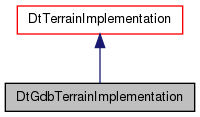
This terrain implementation is a polygonal terrain representation.
Polygons can have a soiltype defined and an associated color. It is in the GDB format which holds both the polygons and any associated vector features.



 Public Member Functions inherited from DtTerrainImplementation