Constructor & Destructor Documentation
| makVrv::DtOceanStateInterface::DtOceanStateInterface |
( |
DtDe & |
de | ) |
|
| virtual makVrv::DtOceanStateInterface::~DtOceanStateInterface |
( |
| ) |
|
|
virtual |
Member Function Documentation
| virtual bool makVrv::DtOceanStateInterface::getIsUnderwater |
( |
| ) |
const |
|
virtual |
| virtual bool makVrv::DtOceanStateInterface::isOverWater |
( |
const DtVector & |
localPosition, |
|
|
bool |
isVisible = true |
|
) |
| |
|
virtual |
Returns whether we are currently over water.
This can't be implemented correctly until we have coastal boundaries. For now, we use the returned height of an terrain intersect call - sea level is water, anything higher is not. The isVisible flag allows for an optimization when Triton ocean is used. The optimization is used by default; the isVisible flag says that the query position is close enought to an observer so that a height map should be available for use. This is often the case when doing intersections involving objects/effects that are LOD's in/out; if the object is close enough to an observer to be of interest (a rotor wash or wake, say) then it can use the height map optimization. If you do not know if the query position is close to an observer, than set isVisible to false, in which case the terrain intersection method will be used.
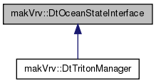
Reimplemented in makVrv::DtTritonManager.
| virtual float makVrv::DtOceanStateInterface::getMaximumWaveHeight |
( |
| ) |
|
|
virtual |
| virtual float makVrv::DtOceanStateInterface::seaLevel |
( |
| ) |
const |
|
virtual |
Member Data Documentation
| DtDe& makVrv::DtOceanStateInterface::myDe |
|
protected |
The documentation for this class was generated from the following file: