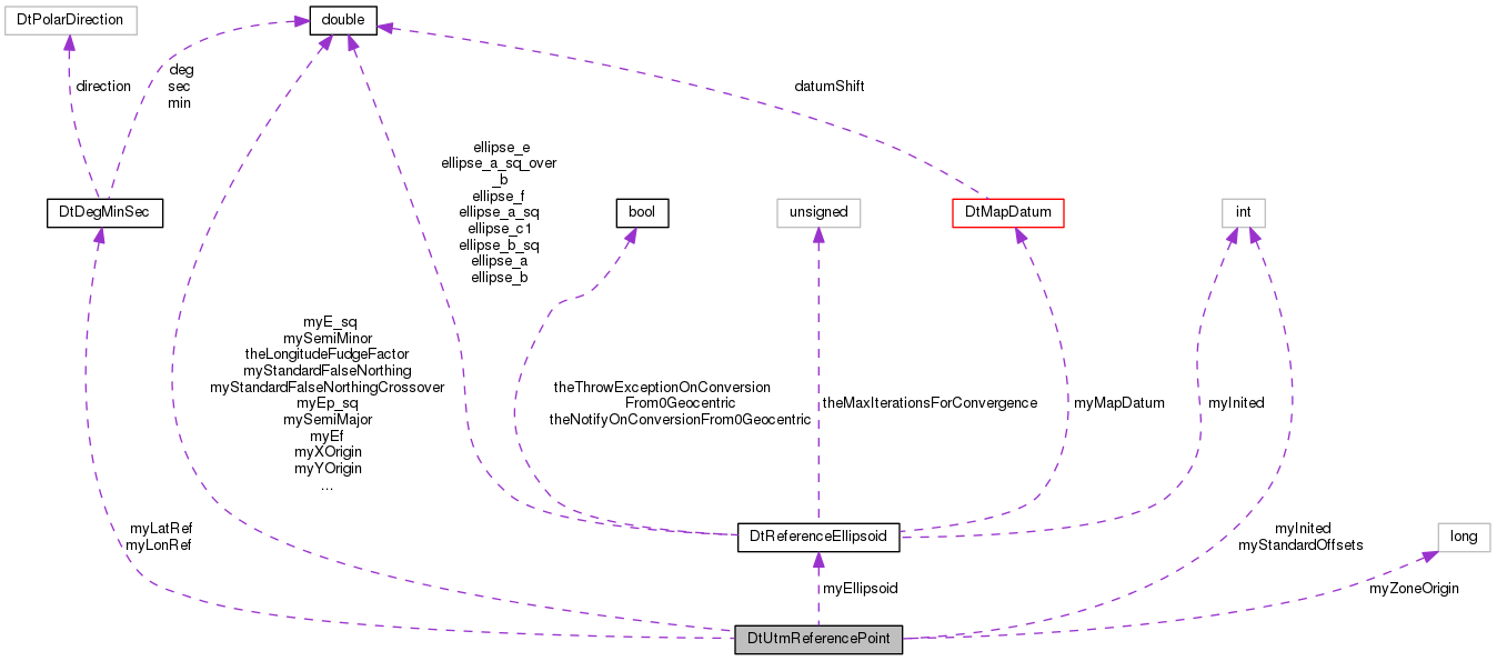
DtUtmReferencePoints are used to represent an independent reference point for a UTM coordinate system.
More...
|
| | DtUtmReferencePoint () |
| | Default CTOR. More...
|
| |
| | DtUtmReferencePoint (const DtDegMinSec &latRef, const DtDegMinSec &lonRef, int standardOffsets=1, long zone=0, const DtMapDatum &mapDatum=DtCurrentMapDatum(), double scaleFactor=0.9996) |
| | Constructor lat lon are represented by deg, min, sec, direction, where positive direction is north & WEST. More...
|
| |
| virtual | ~DtUtmReferencePoint () |
| | Default DTOR. More...
|
| |
| virtual void | geod2utm (double alat, double alon, double *x, double *y) |
| | Convert between geodetic and utm (geodetic lat & lon need to be in radians) More...
|
| |
| virtual void | utm2geod (double x, double y, double *lat, double *lon) |
| | Convert between utm and geodetic (geodetic lat & lon will be in radians) More...
|
| |
| virtual const DtMapDatum & | mapDatum () const |
| | get the MAP Datum to be used with this reference point More...
|
| |
| virtual void | useMapDatum (const DtMapDatum &mapDatum) |
| | set the MAP Datum to be used with this reference point More...
|
| |
virtual const
DtReferenceEllipsoid * | ellipsoid () const |
| | return the reference ellipsoid used by our DtMapDatum More...
|
| |
| void | init (const DtDegMinSec &latRef, const DtDegMinSec &lonRef, int standardOffsets=1, long zone=0, const DtMapDatum &mapDatum=DtCurrentMapDatum()) |
| | Initializes the UTM reference point. More...
|
| |
| virtual void | uninitialize () |
| | Uninitializes the reference point. More...
|
| |
| virtual bool | isInitialized () const |
| | Returns true if the reference point is initialized, and false otherwise. More...
|
| |
| virtual double | scale () const |
| | Returns the UTM scale. More...
|
| |
| virtual void | setScale (double scale) |
| | Sets the UTM scale. More...
|
| |
| virtual double | xOrigin () const |
| |
| virtual void | setXOrgin (double x_origin) |
| |
| virtual double | yOrigin () const |
| |
| virtual void | setYOrgin (double y_origin) |
| |
| virtual int | standardOffsets () const |
| |
| virtual void | setStandardOffsets (int so) |
| |
| virtual DtDegMinSec | latRef () const |
| |
| virtual void | setLatRef (const DtDegMinSec &lat_ref) |
| |
| virtual DtDegMinSec | longRef () const |
| |
| virtual void | setLongRef (const DtDegMinSec &lat_ref) |
| |
| virtual long | zoneOrigin () const |
| |
| virtual void | setZoneOrigin (long zo) |
| |
| virtual double | standardFalseEasting () const |
| |
| virtual void | setStandardFalseEasting (double sfe) |
| |
| virtual double | standardFalseNorthing () const |
| |
| virtual void | setStandardFalseNorthing (double sfn) |
| |
| virtual double | standardFalseNorthingCrossover () const |
| | The false northing crossover value can be used to specify the range in which conversions between UTM to geodetic can take place. More...
|
| |
| virtual void | setStandardFalseNorthingCrossover (double sfnc) |
| |
|
| void | initDatumConstants () |
| |
| void | initUtm (const double lat[4], const double lon[4], long zone=0) |
| |
| void | degree (const double a[3], double *b) const |
| |
|
| virtual void | geod2utm (double lat, double lon, long *zone, double *northing, double *easting) |
| | These conversion utilities do all the hard work lat and lon are always in deg,min,sec format. More...
|
| |
| virtual void | utm2geod (double northing, double easting, long zone, double *lat, double *lon) |
| | These conversion utilities do all the hard work lat and lon are always in deg,min,sec format. More...
|
| |
DtUtmReferencePoints are used to represent an independent reference point for a UTM coordinate system.
In older versions of VR-Link UTM conversions depended on a single Reference point which was set with the DtUtmInit call. All UTM conversions later were preformed with regards to that initial point. This class is used to allow the user to choose a different point for every conversion. An example of this is provided in the VR-Link users guide in section 5.12
| virtual double DtUtmReferencePoint::standardFalseNorthingCrossover |
( |
| ) |
const |
|
virtual |
The false northing crossover value can be used to specify the range in which conversions between UTM to geodetic can take place.
In UTM, northing values run from 0 - 10000000 from the south pole to the equator and 0 - 10000000 from the equator to the north pole. This means that based solely on the northing value we cannot determine whether we are in the southern or northern hemisphere. The false northing crossover tells us at what value to assume that we are in the southern hemisphere. Any northing values above the crossover value will be assumed to be southern, any values below will be assumed to be northern. The default value is



 Collaboration diagram for DtUtmReferencePoint: