Public Member Functions |
| | DtGdbTerrainImplementation (DtConsoleCommandManager *cmdMgr) |
| virtual | ~DtGdbTerrainImplementation () |
| virtual bool | loadTerrain (const makArchives::DtGenericTerrainRecord &record, MAKVRinTerra::DtFeatureLoader &, const TerrainSettings &settings=TerrainSettings()) |
| | Loads a terrain given the terrain record and a key/value pair of settings.
|
| virtual const Coordinate_System * | coordinateSystem () const |
| virtual bool | chordIntersect (const DtChord &chord, DtChordIntersectionRecord &record, DtIntersectionRecord::DtIntersectionType irtFlag=DtIntersectionRecord::INT_ALL_DATA, bool *dataAvailable=0, bool overrideBlockingAssert=false) const |
| | Returns topmost intersection of chord with terrain in record.
|
| virtual bool | allIntersectsAlongChord (const DtChord &chord, DtChordIntersectRecordList &intList, DtIntersectionRecord::DtIntersectionType irtFlag=DtIntersectionRecord::INT_ALL_DATA, bool *dataAvailable=0, bool overrideBlockingAssert=false) const |
| | Returns all intersections of chord with terrain.
|
| virtual bool | sphereIntersect (const DtSphere &sphere, DtSphereIntersectionRecord &record, DtIntersectionRecord::DtIntersectionType irtFlag=DtIntersectionRecord::INT_ALL_DATA, bool *dataAvailable=0, bool overrideBlockingAssert=false) const |
| | Returns intersection of sphere with the terrain in the record irtFlag specifies what intersection data should be filled in for the record.
|
virtual const
DtTerrainCapabilities * | terrainCapabilities () const |
| virtual void | processTrianglesInArea (DtTriangleCallbackFcn func, DtTriangleCallbackFinalizeFcn finalize, DtTerrainProcessPolygonsBox &box, void *usr) const |
| virtual void | consumeNode (DtGdbNode *gdbNode, DtTerrainProcessPolygonsBox &box, DtTriangleCallbackFcn func, void *usr) const |
| | DtTerrainImplementation (DtConsoleCommandManager *cmdManager) |
| virtual | ~DtTerrainImplementation () |
| virtual void | preloadTerrainAreas (const DtTerrainPagingGeometryList &preloadGeometry) |
| | Specifies a list of terrain areas that should be preloaded by the terrain implementation, in the case of a paging or streaming terrain source.
|
| virtual void | setIntersectDataLoadExpireTime (const double &expireTime) |
| | No-op.
|
| virtual void | expireDataLoadRequestsBeforeTime (const double ¤tTime) |
| | No-op.
|
| virtual void | breakUpChords (const MAKVRinTerra::DtProj &, const DtChord &chord, std::vector< DtChord > &chords) |
| const TerrainSettings & | settings () |
| | Returns settings.
|
| void | setFeatureContext (const boost::scoped_ptr< MAKVRinTerra::DtFeatureContext > &fc) |
| | Sets the feature context for use in lookups.
|
| virtual void | setAssertOnBlockingTerrainCalls (bool assertBlock) |
| | Determines if an exception should be thrown if a blocking terrain call is made.
|
| virtual bool | assertOnBlockingTerrainCalls () const |
| | Determines if an exception should be thrown if a blocking terrain call is made.
|
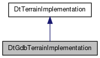
This terrain implementation is a polygonal terrain representation.
Polygons can have a soiltype defined and an associated color. It is in the GDB format which holds both the polygons and any associated vector features.

 Public Member Functions inherited from DtTerrainImplementation