 |
VR-Forces 4.8 Class Documentation
|


All Classes Namespaces Files Functions Variables Typedefs Enumerations Enumerator Properties Friends Macros Groups Pages
|
VR-Forces 4.8 Class Documentation
|
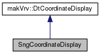
The SngCoordinateDisplay class provides the ability for VR-Vantage to display Swiss grid geographic coordinate system. More...
Public Member Functions | |
| SngCoordinateDisplay (const makVrv::DtCoordinateSystem &cs) | |
| CTOR. More... | |
| DistanceUnits | xUnitsFor (DistanceUnits unit) |
| Get the x units for this coordinate display (Meters) More... | |
| DistanceUnits | yUnitsFor (DistanceUnits unit) |
| Get the y units for this coordinate display (Meters) More... | |
| DistanceUnits | zUnitsFor (DistanceUnits unit) |
| Get the z units for this coordinate display (Meters) More... | |
| virtual makVrv::DtUnicode | xAxisLabel () |
| Return the label that will be used for x values in the GUI ("E ") More... | |
| virtual makVrv::DtUnicode | yAxisLabel () |
| Return the label that will be used for y values in the GUI ("N " ) More... | |
| virtual makVrv::DtUnicode | zAxisLabel () |
| Return the label that will be used for z values in the GUI ("Alt " ) More... | |
| virtual makVrv::DtUnicode | northSouthGridLabel (DistanceUnits unit, const DtVector &geocPos, int decimals, double gridSpacing) |
| Get the (numeric) label for a north/south grid line at geocPos. More... | |
| virtual makVrv::DtUnicode | eastWestGridLabel (DistanceUnits unit, const DtVector &geocPos, int decimals, double gridSpacing) |
| Get the (numeric) label for an east/west grid line at geocPos. More... | |
| virtual std::vector< std::string > | convertPositionToStringList (DistanceUnits unit, const DtVector &geocPos, int decimals) |
| Convert the specified geocPos to an x/y/z list of values, using the specified distance unit (m, ft, etc) and the decimal precision indicated. More... | |
| virtual void | convertToGeocentric (const std::string &x, const std::string &y, const std::string &z, DistanceUnits distUnits, DistanceUnits altUnits, DtVector &vector) |
| Convert a local position in x,y,z string form to geocentric coordinates, given that the x and y strings represent distUnits and the z value represents altUnits. More... | |
| virtual makVrv::DtUnicode | name () |
| The name of this coordinate display (which will appear in combo boxes in the GUI. More... | |
| virtual makVrv::DtCoordinateDisplay * | clone () const |
| Clone a copy of this coordinate display object. More... | |
| DtVector | convertFromGeocentric (const DtVector &geoc) const |
| Conversion function for local to geocentric conversion. More... | |
| DtTaitBryan | headingPitchRollFor (const DtVector &location, const DtTaitBryan &geocOri) const |
| Heading pitch and roll function. More... | |
| DtTaitBryan | localOrientationFor (const DtVector &location, const DtTaitBryan &geocOri) const |
| Orientation function. More... | |
| DtTaitBryan | orientationFor (const DtVector &location, const DtTaitBryan &geocOri, bool local) const |
| Orientation function. More... | |
| void | regularExpressionValidator (std::string &x, std::string &y, std::string &z) |
| Regular expression validators for coordinate input. More... | |
 Public Member Functions inherited from makVrv::DtCoordinateDisplay Public Member Functions inherited from makVrv::DtCoordinateDisplay | |
| DtCoordinateDisplay (const DtCoordinateSystem &coordSys) | |
| CTOR DtUnitConverterCollection is a collection of classes used to convert between different units (meters, feet, miles, etc.) DtCoordinateSystem is used to do coordinate system conversions, when possible. More... | |
| virtual | ~DtCoordinateDisplay () |
| DTOR. More... | |
| virtual DtUnicode | gridBoxLabel (const DtVector &lowerLeftGeocPos, const DtVector &upperRightGeocPos) |
| Some systems (such as MGRS) are not just positions but boxes with grid designators. More... | |
| virtual DtUnicode | northSouthGridLabel (OrientationUnits unit, const DtVector &geocPos, int decimals, double gridSpacing) |
| Get a north / south label with angular units. More... | |
| virtual DtUnicode | eastWestGridLabel (OrientationUnits unit, const DtVector &geocPos, int decimals, double gridSpacing) |
| Get an east / west label with angular units. More... | |
| virtual bool | clipXToGrid (double inStartX, double inEndX, double constantY, double &clippedStartX, double &clippedEndX) |
| Clip a line segment in LOCAL coordinates to an existing grid defined by this coord system, if any. More... | |
| virtual bool | clipYToGrid (double inStartY, double inEndY, double constantX, double &clippedStartY, double &clippedEndY) |
| Returns false if entire segment is outside grid. More... | |
| virtual void | shiftGridLineAnchors (double xSpacing, double ySpacing, double &shiftX, double &shifY) |
| Normally, grid lines are started at database 0,0. More... | |
| virtual bool | usesDecimalsOnGridLines () const |
| Enable/disable the decimals spinbox on grid settings dialog. More... | |
| virtual double | maxGridSpacing () const |
| Maximum grid spacing allowed. 0. returned if unlimited. More... | |
| virtual double | minGridSpacing () const |
| Minimum grid spacing allowed. 0. returned if unlimited. More... | |
| virtual DtTaitBryan | topoOrientationFor (const DtVector &geocPos, const DtTaitBryan &geocOri) const |
| virtual DtVector | geocToLocalVector (const DtVector &geocLoc, const DtVector &geocVec) const |
| const SupportedPositionDistanceUnits & | supportedPositionDistanceUnits () const |
| Retrieve the the list of DistanceUnits supported by this cs display for displaying positions (coordnates).Different coordinate displays can support different distance units for position display (or, in some cases, none). More... | |
| bool | isSupportedPositionUnit (DistanceUnits unit) const |
| Determine if the specified distance unit is supported. More... | |
| void | addSupportedPositionUnit (DistanceUnits unitToSupport) |
| Add support for a new distance unit type. More... | |
| void | removeSupportedPositionUnit (DistanceUnits unitToRemove) |
| Remove support for a distance unit type. More... | |
| const SupportedPositionAngularUnits & | supportedPositionAngularUnits () const |
| Retrieve the the list of OrientationUnits supported by this cs display. More... | |
| bool | isSupportedPositionUnit (OrientationUnits unit) const |
| Determine if the specified distance unit is supported. More... | |
| void | addSupportedPositionUnit (OrientationUnits unitToSupport) |
| Add support for a new distance unit type. More... | |
| void | removeSupportedPositionUnit (OrientationUnits unitToRemove) |
| Remove support for a distance unit type. More... | |
| const SupportedCSForGridLines & | supportedCSForGridLines () const |
| Retrieve the the list of coordinate systems that can have grid lines drawn using this display type. More... | |
| bool | isSupportedCSForGridLines (const std::string &cs) const |
| Determine if this display supports grid lines for the specified coordinate system. More... | |
| void | addSupportedCSForGridLines (const std::string &cs) |
| Add grid line support for a coordinate system. More... | |
| void | removeSupportedCSForGridLines (const std::string &cs) |
| Remove grid line support for a coordinate system. More... | |
Static Public Attributes | |
| static const CoordSys | CoordSysSNG |
Static Protected Member Functions | |
| static void | convertWGS84ToSNG (const DtVector &InVector, DtVector &OutVector) |
| Convert from WGS 84 Geocentric to Swiss National Grid (SNG) More... | |
| static void | convertSNGToWGS84 (const DtVector &InVecPos, DtVector &OutVecPos) |
| Convert from Swiss National Grid (SNG) to WGS 84 Geocentric. More... | |
The SngCoordinateDisplay class provides the ability for VR-Vantage to display Swiss grid geographic coordinate system.
| SngCoordinateDisplay::SngCoordinateDisplay | ( | const makVrv::DtCoordinateSystem & | cs | ) |
CTOR.
|
virtual |
Get the x units for this coordinate display (Meters)
Implements makVrv::DtCoordinateDisplay.
|
virtual |
Get the y units for this coordinate display (Meters)
Implements makVrv::DtCoordinateDisplay.
|
virtual |
Get the z units for this coordinate display (Meters)
Implements makVrv::DtCoordinateDisplay.
|
virtual |
Return the label that will be used for x values in the GUI ("E ")
Implements makVrv::DtCoordinateDisplay.
|
virtual |
Return the label that will be used for y values in the GUI ("N " )
Implements makVrv::DtCoordinateDisplay.
|
virtual |
Return the label that will be used for z values in the GUI ("Alt " )
Implements makVrv::DtCoordinateDisplay.
|
virtual |
Get the (numeric) label for a north/south grid line at geocPos.
Reimplemented from makVrv::DtCoordinateDisplay.
|
virtual |
Get the (numeric) label for an east/west grid line at geocPos.
Reimplemented from makVrv::DtCoordinateDisplay.
|
virtual |
Convert the specified geocPos to an x/y/z list of values, using the specified distance unit (m, ft, etc) and the decimal precision indicated.
Implements makVrv::DtCoordinateDisplay.
|
virtual |
Convert a local position in x,y,z string form to geocentric coordinates, given that the x and y strings represent distUnits and the z value represents altUnits.
Implements makVrv::DtCoordinateDisplay.
|
virtual |
The name of this coordinate display (which will appear in combo boxes in the GUI.
Implements makVrv::DtCoordinateDisplay.
|
virtual |
Clone a copy of this coordinate display object.
Implements makVrv::DtCoordinateDisplay.
Conversion function for local to geocentric conversion.
Implements makVrv::DtCoordinateDisplay.
|
virtual |
Heading pitch and roll function.
Implements makVrv::DtCoordinateDisplay.
|
virtual |
Orientation function.
Implements makVrv::DtCoordinateDisplay.
| DtTaitBryan SngCoordinateDisplay::orientationFor | ( | const DtVector & | location, |
| const DtTaitBryan & | geocOri, | ||
| bool | local | ||
| ) | const |
Orientation function.
|
virtual |
Regular expression validators for coordinate input.
Implements makVrv::DtCoordinateDisplay.
|
staticprotected |
Convert from WGS 84 Geocentric to Swiss National Grid (SNG)
|
staticprotected |
Convert from Swiss National Grid (SNG) to WGS 84 Geocentric.
|
static |